
Geography & Geology
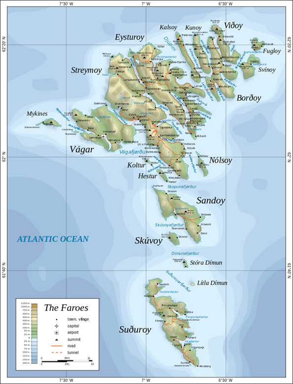
- Forming part of the North Atlantic basalt area, which stretches from Ireland to Greenland, the 18 Faroe Islands have been moulded in a volcanic layering process.
- The islands cover an area of around 1.400 km2 (540 sq mi).
- The islands are divided into six regions, known as sýslur. These are: Norðoyar, Eysturoy, Streymoy, Vágar, Sandoy and Suðuroy.
- The Faroese coastline is approximately 1,117 kilometres (694 mi).
- There is only one significant uninhabited island. The island is called Lítla Dímun, meaning "little Dímun", as it neighbours "Stóra Dímun" (Big Dímun).
- Slættaratindur is the country's highest point. Towering at 882 metres above sea level.
To read more about the geography of the Faroe Islands, visit: https://visitfaroeislands.com/en/about1/nature-environment/geography